Sunday, October 30, 2011

Another season over


View Larger Map

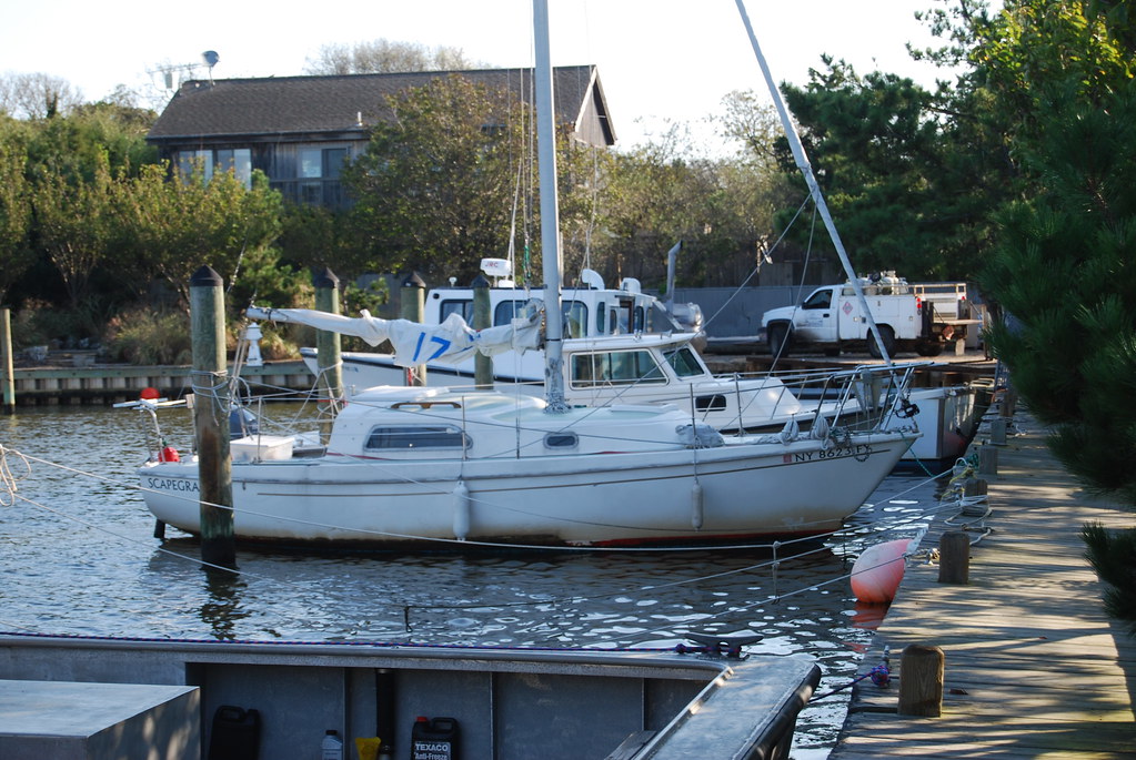
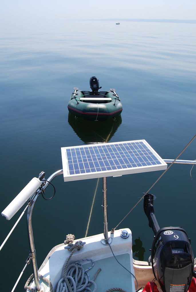
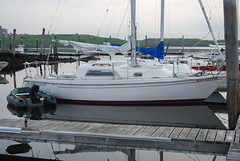
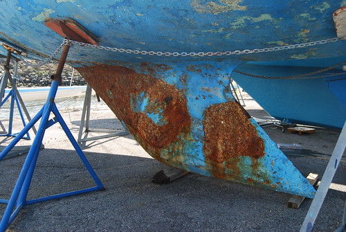
The Scapegrace turns into a pumpkin, as far as the 79th Street Boat Basin is concerned, on November 1. So this weekend I finally bowed to seasonal necessity and took her around to the Bronx, to Charlie Evers' wonderful boatyard, for the winter. I was expecting a milk run, having done this trip now a number of times. But I should have known better. Dat ole debbil, sea!

Here's the first odd thing. Getting out of the boat basin's crowded mooring field in a three- or four-knot current is a little tricky. One of the things you learn, after you've done it a few times, is what an mooring buoy looks like when it's been pulled mostly underwater by the current. (You do not want to run into one of these.)

They're round, the buoys, and they're never far underwater -- barely submerged, at most. So the water pillows up into a little smooth mound over the buoy, and there's a little turbulent wake downstream of it.

I worked my way through these menaces out of the mooring field into the channel -- or so I thought -- and started to breathe normally again, when I noticed, slightly off the starboard bow, a little lump of water, smoothly pillowed-up over something round, way further out into the channel than I would have expected a mooring buoy to be. And the wake looked different -- not just a patch of lumpy disturbed water downstream of the buoy, but a distinct vee-shaped wake, like what a boat would leave, or a rock in a fast-flowing freshwater stream.

Ten seconds' observation revealed that this object, whatever it was, was not stationary. It was forging upstream, at maybe two knots over the ground; five or six through the water.

Mooring buoys do not behave this way.

It was a whale, of course -- clearly a deeply bewildered whale, headed for Rockland County, with very little to expect in the way of cetacean amenities when it got there.

I tried to follow this poor devil for a while. All I could see was the very top and back of his or her head -- grayish, or rather tarnished-silvery in color; smoothly rounded; a conspicuous blowhole, single, not twinned, as far as I could tell. No clear idea how big the the underwater part was. I'm guessing maybe twenty feet.

He or she was stemming the current a lot faster than I could do. If I could have kept up, I think I would have followed this critter till I ran out of gas for the outboard. But no way; Leviathan had the advantage of what, a few million years of evolution, and Leviathan meant business. After five minutes of vain pursuit, Leviathan was a mere indistinct bump on the water, two hundred yards ahead; and so I reluctantly turned and left Leviathan to his fate, and pursued my own.

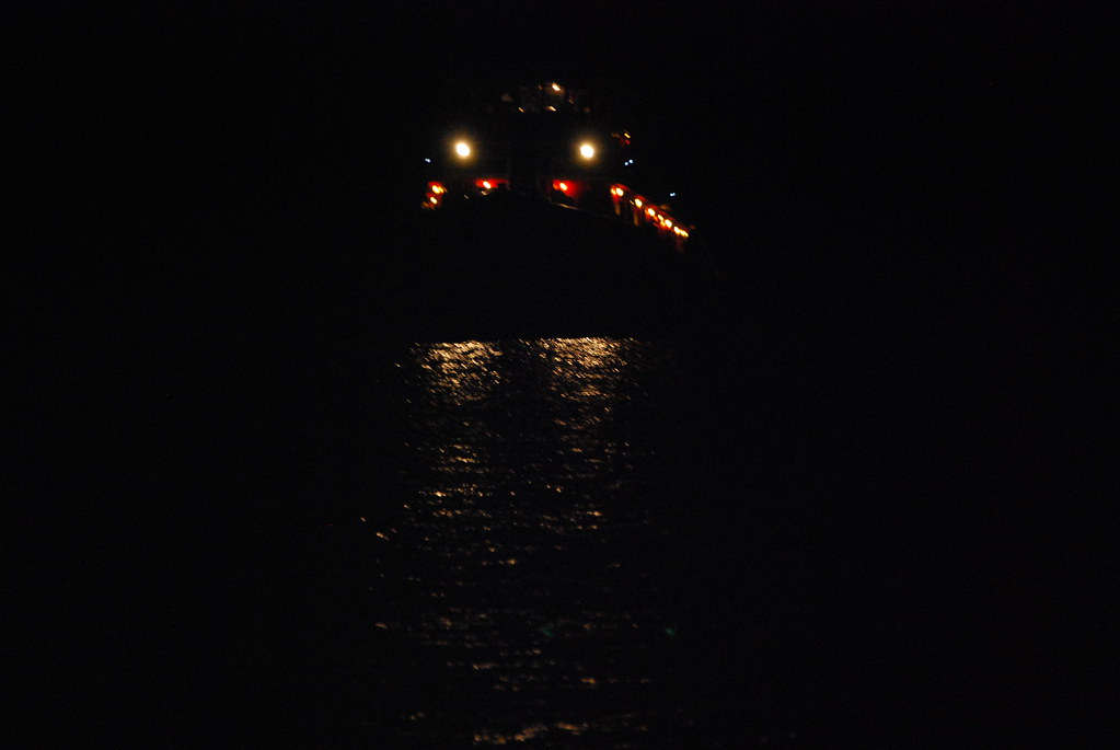
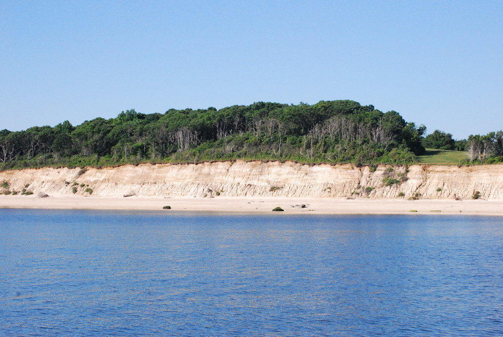
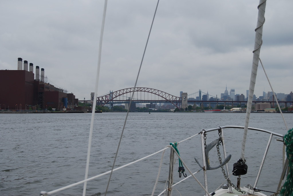
After this memorable encounter, it was an otherwise uneventful trip. Night fell, as it is wont to do. But I know the Hudson River and Hell Gate quite well, now, and motored -- no wind, alas -- blithely around the island and under the bridges and through the crazy swirling currents of Hell Gate without even glancing at the chart. (Ordinary I am a compulsive chart-watcher, so this was unusual, and I felt rather smug about it.)

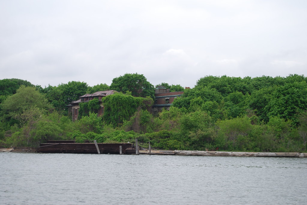
Got into Eastchester Bay, and dropped anchor at about the spot shown on the map above, around 10 PM. I didn't want to try getting into Charlie's yard in the dark. Here's a closeup that may explain why:


View Larger Map

Close quarters and tricky turns.

I have anchored for the night at more or less the same position before, at the entrance to the bay, and spent a quiet night snoring tranquilly in the vee-berth. But this was not to be a quiet night.

Soon as I turned in, a nor-easter promptly blew up, sent big rollers all the way down the Sound and into shallow Eastchester Bay, where they turned into steep peaky nasty choppy things. Tossing the boat around on the anchor rode like a tetherball; I was worried that the rode might actually snap.

That big bruiser of a Bruce anchor wasn't going anywhere, though, not in that gluey muck of a bottom. Not a hair of anchor dragging, according to the trusty GPS, confirmed by my worried eyeball popping out of the cabin every half hour or so, into a very nasty cold damp night.

It was nasty damp and cold even in the cabin. When I noticed that my hands were shaking, I finally cranked up the little propane heater I bought two years ago, while marooned in Kittery, Maine, and that helped a lot.

Thirty knots of wind, gusting a lot higher. Crazy. Finally got so worried about the anchor rode that I pulled it up and went motoring further up into the bay, looking for a more sheltered spot. While I was doing that it got light.

Still didn't want to try going into the marina with a thirty-knot tail wind -- it's very confined in there and sailboats aren't that maneuverable in tight spaces. But as I was casting about for a suitable anchoring spot, there was a lull in the wind -- down to a reasonable fifteen knots or so -- and it started to snow.

So I nipped into the marina and if I do say so myself, got the boat into a vacant slip rather neatly.

Why is there never anybody watching when you do it right for once, I'd like to know?

Exhausted. Took a little nap on the boat, not having had much sleep during the night, then walked to the subway. Downed trees in the park, garbage cans blown all over the homely streets of the bungalow Bronx, and fat damp snowflakes landing on the hood of my jacket with an audible thump.

There's no such thing as a milk run.

Wednesday, October 5, 2011

And now for something completely different

That's the Scapegrace, looking almost as out of place at Fire Island Pines as her skipper. (Click to enlarge as usual). Note the ugly sludgy ring of gunk at the waterline; that's the Hudson River for you.

Penelope has friends staying here at the Pines, so she wisely took the train and ferry out, and I sailed the Scapegrace -- probably my last hurrah this season -- and joined them. I expect it's a pretty lively place during the season, but it's very peaceful now.

Took off from the boat basin about five PM yesterday; motored down the Hudson. Once past the Verrazano Bridge we picked up a light northwest breeze and moved along at three or four knots. A bit after midnight I got so cold and so tired that I hove-to on the starboard tack -- just off Long Beach Island, I think -- and took a nap.

Awoke about three, a couple of miles farther out, but having lost no ground. The wind had strengthened a good deal and so we bowled along at five and six knots. Reached Fire Island Inlet about eight, and motored in against the current.

Once inside Great South Bay it proved to be possible to sail (under jib alone) most of the way to the Pines, though I went slightly aground once, on the soft sand, trying to creep from buoy to buoy in the twisty channel. The motor backed the boat off quite nicely.

Then a squall blew in, and the jib sheet jammed on the winch, and I went in circles for about ten minutes in alarmingly shallow water, swearing at the top of my lungs the whole time. Finally got the jib sheet free, and decided the better part of valor was to motor the rest of the way to the Pines marina:


View Larger Map

The marina is a very nice spot:

Friday, July 15, 2011

Photo gallery

Click to see full-size, as usual.

Aquambulists at Milford, mentioned earlier. A close look at the satellite view in that original post -- you may have to zoom in -- will unravel the mystery.

The electricity perplex.

I've had the terrible experience of having the nav lights go dim and then dead at the Hour of the Wolf, in the middle of Cape Cod Bay. This is a bad feeling. I replaced my inherited battery -- a starting battery, actually, which I don't need -- with a more capacious deep-cycle battery; but I'm still very paranoid and Pere-Goriot about amps. So I've embarked on an amp-saving campaign. Among other things, I've replaced the incandescent cabin light bulbs with LED versions. Here's the old inefficient bulb:

And here's the nice new efficient LED bulb, consuming, what, a tenth of the current the old one did. It's shown in situ:

It may be more efficient, but it sure spoils the retro Jetsons look of that original-equipment 1970s light fixture, doesn't it? Looks like some ill-bred child sticking his tongue out. The light quality is colder and less homey, too.

LED replacements for the nav light bulbs are next, though that may have to wait till next year.

I also sprang for a solar panel to charge the battery whenever the sun shines:

This image also shows the new dinghy -- I have yet to tell that story -- and a weird cylindrical object on the rail, over to the left, which is the receptacle for an imposing seven-foot LORAN antenna, now languishing in a Harlem storage locker.

You don't want to touch that antenna without gloves on -- it's made out of somewhat sun-degraded fiberglass, and it's like handling a cactus. Tiny splinters of glass fiber work their way under your skin, and itch for the next week.

There's a LORAN unit in the cabin, which actually worked when I first got the boat, and of course works no more, because the Coast Guard finally shut down the LORAN system last year.

I only once ever navigated a boat using LORAN, and that was, what, twenty years ago? The charts then used to have a Cabbalistic LORAN overlay.

Ah, progress. GPS is a lot easier(*). So I ought to take the antenna receptacle off the rail, and remove the obsolete receiver from the cabin. But I probably won't. I have a kind of preservationist mentality. I like the Scapegrace's period feel and won't change it any more than I can help.

Finally, here's the sort of thing you can see off your starboard quarter, at anchor in Port Jefferson, if you happen to wake up in the middle of the night:

It's not quite as scary as it appears. There's a big industrial mooring buoy a hundred fifty feet or so from where I anchored in Port Jeff, and tugs and barges use it a lot. This particular tug came in, during the wee hours, and tied up to the buoy. The subdued rumble of its idling engines woke me up, and I took the picture. The next morning, shortly after sunrise, a huge fuel barge came majestically into the harbor, bound for the Port Jeff power plant, and my neighbor cast off and went to help it dock.

----------------

(*) Though the FCC has apparently given GPS' adjacent frequency band to some fella called Sanjiv Ahuja, proprietor of an outfit called Lightsquared, whose business plan is to sell wholesale wireless data channels; not to people like us, but to "people" like Apple and Verizon. The sages predict extensive interference. I can't wait. Groping my way into Buzzards Bay at three AM, in the fog, and suddenly I've got no GPS because Sanjiv just cut a deal with Rupert Murdoch.

Tuesday, July 12, 2011

All downhill from here

When I took the dinghy out of the semi-idyllic Sand Hole, there was actually some wind. By the time I got back on the Scapegrace and got the anchor up -- dying, dying, dead. So in the heat of the day I anchored again and tried to nap, a couple of miles west, off Oak Point:


View Larger Map

After several uncomfortable and steamy hours there, a bit of a breeze came up, from the north-northwest, and I was able to make a long board on the starboard tack past Sands Point and finally anchor, in the dark, in about twenty feet of water off Barkers Point:


View Sands Point, NY in a larger map

In the morning the gloomy vista of Hart Island, mentioned here before (scroll down), was visible a few miles across the Sound. Hart Island is New York's potter's field, where our penurious dead are parsimoniously salted away in six-deep tenements. But at least there, they need no longer fear being rousted by the forces of order or the the indignant proprietors of property. The place is a sort of memento-mori for me, in a way that a more ordinary graveyard is not, and I can never set eyes on it without falling into a very thoughtful state of mind.

Monday, July 11, 2011

A discovery

Attempting to leave Oyster Bay, I found myself becalmed, as usual on this trip, at the very mouth of the harbor. So I decided to improve the time by exploring a place I have often wondered about: the Sand Hole, on the west side of the outermost part of Lloyd's Neck (which forms the eastern side of the Oyster Bay/Cold Spring Harbor complex.) You can see the Sand Hole in context, a little vermiform appendix of water, bounded by sandbars, at the top of the satellite photo on the previous post. Here's a closeup:


View Larger Map

The chart shows enough water for the Scapegrace (which draws four feet) in most of the Sand Hole, except at the narrowest part of the inlet, just after you round the tip of the long rock jetty on the west and head south for a couple hundred feet. At low tide the chart shows three feet of water just there. High tide, of course, would be no problem -- the tide rises about seven feet in these parts -- but then the jetty would be submerged and invisible, a scary idea.

It was low tide when I decided to do my exploring, so I anchored the Scapegrace in the slightly shallower (lighter-colored) open water you can see to the west of the jetty, and take the dinghy in.

The throat of the inlet was indeed very narrow and very shallow -- certainly no more than three feet, maybe less. The current was still running out of it, creating a pleasant little bumpy rapids over the bar. It's one boat at a time -- if somebody's coming out, you wait before you go in.

Once inside, there's a nice Lost World feel, somewhat impaired by menacing signs around the first (southern) baylet you enter: PRIVATE NO LANDING PRIVATE NO ANCHORING PRIVATE PRIVATE PRIVATE GODDAMMIT HOW MANY TIMES DO I HAVE TO TELL YOU. But once you round the point that forms the eastern side of the inlet, and head north into the second baylet, it's all public land, apparently.

This was a Saturday, and the Lost World had apparently been re-found by some denizens of Stamford and such places. But there weren't many -- three or four boats when I came in, and they were all pretty well-behaved. Nobody playing music or shrieking with mirth.

I went to beach the dinghy in the little corner pocket on the west side of the northern baylet, and found to my surprise that you can't. The shore climbs at a forty-five degree angle, or nearly, and the bottom drops off an what appeared to be an even sharper angle below. So you don't slide up onto the sand; you bump into the bank, and your bow is nuzzling it while your stern is in maybe eight feet of water. But there was some kind of wrecked framework of big timbers a few feet up the beach -- the remains of a pier, perhaps? -- and the dinghy's painter extended far enough to secure it to this picturesque ruin.

I walked along the shore toward the east and north, exchanging civilities with a well-spoken small young family -- mom, dad, and tot -- paddling in the water near their motorboat, which they had backed up to the shore; that tells you how fast the bottom falls off. They had brought an anchor twenty feet or so up the shore, buried it in the sandy gravel, and put a big flat rock on top to keep the boat in place. Perhaps there was another anchor out in the water; I didn't notice.

There's a path that leads up into the scrub woods toward the north. Twenty feet from the water and all the smells change: dry, spicy, a little sweet and floral. There were some kind of cactus, or what looked like cactus to me, growing rife in little clearings, with very showy complicated big yellow flowers. Somehow I don't associate cactus with Long Island. I wish I knew the names of plants and birds, but alas, it's a closed book to me.

I wandered up a couple of the little ankle-deep rivulets that drain the big salt marsh to the east; this was really a lost world -- not a human sound; just the distant growl of the surf on the outside of the sandbar, the trickle of the little streams, the various cries of birds, so unintelligible and meaningless to an ornithomoron like me; it was like walking down the sidewalk in some parts of Queens and hearing languages that you can't even begin to identify; couldn't even tell what part of the world they might be from.

Had a quick and refreshing swim in the northern baylet. It was starting to get crowded -- some idiot even had a jet-ski, though he hadn't started using it yet -- and I packed myself into the dinghy and returned to the Scapegrace. I'd like to come back, on a weekday perhaps, after Labor Day, and try to bring the sailboat in -- though that initial entry would have me chewing my knuckles.

Friday, July 8, 2011

Ruled by the wind...

... and circumstance.

An east wind this morning, after very discouraging progress toward Maine. And much to do back in New York. I hate a ticking clock -- they make me utterly miserable -- so I took the hint and turned back toward New York.

The Gods, acknowledging my submission, were kind.

Sir, no man's enemy, forgiving all, 
But will its negative inversion, be prodigal!
The east wind remained steady and whisked me across 24 miles of Long Island Sound in an afternoon, a very pleasant ride -- the sort of thing that might make a sail-hater reconsider.

But then the sail-hater would have re-reconsidered. Just outside Oyster Bay harbor, the wind died, and the rain came; but I motored in, glad for the coolness and the wet -- wearing a bathing suit and a ratty old cotton polo shirt for the first hour, and loving it, till finally I had to put on a jacket.

Oyster Bay/Cold Spring is a much-recessed harbor, a hassle to get in and out of. I want to be out soon, and I'm not expecting any heavy weather, so I dropped the hook in a non-standard anchorage:


View Larger Map

Weird waters -- the depth goes from sixty feet to twelve in half a second.

I continue to be amazed by the relentless voracious beach flies -- "greenheads", I think they're called, at least on Cape Cod. Sunset, temp in the sixties, rain pouring down, I'm scrambling around trying to dowse the mainsail and start the motor and keep the dinghy's towline from fouling the motor's prop; and a dozen greenheads are circling my naked shins like, I dunno, bail bondsmen at The Tombs. Every five seconds or so, one darts in like a dive bomber, grabs a chunk of high-fed Upper West Side flesh, and flies away before I can even start thinking about swatting him (or her? I can't tell).

The rain does slow 'em down. But even so, they're too fast for me.

About last night...


View Larger Map

Here's where I spent it, anchored behind Charles Island off Milford, Connecticut, a pretty spot. The town of Milford is a mixed bag. The public library (for fast free Wifi) is within walking distance of the town landing, as are several restaurants and the Metro-North suburban rail station, but apparently no grocery store, at least according to the pleasant girls in the restaurant where I ate dinner. (Of course suburban notions of "walking distance" are problematic and highly variable.) Anyway, no orange juice for me in the next couple of days.

While I was dining in high Milford style, another boater had come into the anchorage and situated himself far too close to me. I monitored the situation at intervals for a couple of hours, and finally concluded that we were going to bump into each other during the night. So I hauled up the anchor and moved.

It wasn't as difficult as it might have been, since the little anchorage has a nice even bottom with no nasty rocks. I had to put-putt around for a quarter of an hour so so, to find a spot that was reasonably sheltered by the island, and far enough from the other eight or nine boats, and far enough from the island that I wasn't likely to swing into shoal water.

Considerable rain and thunder during the night, which brought the temperature down nicely -- I was still sweating when I went to bed. Now a gray and cooler morning, with muttered threats of thunderstorms on the weather radio and a wind from the southeast.

What is to be done?

Thursday, July 7, 2011

Escape from Port Jefferson -- sorta

When last heard from, your correspondent was languishing on a windless Wednesday in Port Jefferson, New York, which is a nice anchorage and not altogether an uninteresting place. There is a ferry which runs from there to Bridgeport, Connecticut, a place that will live in infamy as the home of Joe Lieberman.

I regret to say the ferries are car ferries; but as a result they are impressively large craft, and it's quite something to see them surging in and out of the narrow harbor. One of them is named the P. T. Barnum, which tickles me when I hear it calling on the VHF: "Securite securite, P T Barnum leaving Port Jefferson." I want to call back and say "This way to the egress, PT," but so far I have restrained the impulse. Wisecracks don't seem to be much indulged in on Channel 13.

Anyway, I ended up spending all day yesterday (Wednesday 6 July) and last night in Port Jeff. No wind in the morning, and then I had to wait for high tide to bring the Scapegrace up to the fuel dock and fill up the water tank. That was about 3 PM, and once it was accomplished, the weather radio was uttering dire threats about severe thunderstorms; and I don't love sailing at night, anyway. (I was planning on heading for Mattituck, which is about 24 miles away, and there's really nothing resembling a harbor or an anchorage anywhere in between.) So discretion -- or laziness -- triumphed and I dropped the hook again in Port J and spent the night.

The thunderstorms never materialized, though it did get a little breezy for about an hour.

This morning the wind situation looked a little better, so I fared forth. Of course, half a mile out of the harbor, the wind died.

Okay, I thought, I'll wait and see what happens. It's really quite unpleasant being out on the boat on a cloudless day in July, with no wind; the sun beats down into the cockpit, the cabin is an oven, and the sweat runs off you in rivers and literally pools under your ass if you sit down, and drips off your face if you bend over.

Finally a breath of breeze -- but dead foul; from the east; so I decided to modify my plan and head across the Sound to Milford, Connecticut, a place I've never been.

The little easterly breeze moved me along at two knots or so for a couple of hours -- then, you guessed it, died. In disgust I motored the last eight miles into Milford harbor, which has its charm. I'll write more about it anon.

Two hours of motoring full-throttle with my little Tohatsu 6 hp outboard consumed a gallon and a half of gas (or maybe a little less). It moves me along at four and a half knots and a bit, if I'm towing the dinghy (as I am). It's nice to know these stats but I never seem to take note of them.

Being in Port Jeff reminded me of a crazy windsurfing incident when I was much younger (though still old enough to know better). Maybe I'll write that up one of these days.

Wednesday, July 6, 2011

Sights of the Sound

Holed up in the Port Jefferson public library; no wind. Here are some pictures. Click on 'em to get a bigger version:

Escape from New York:

Monstrosity in Oyster Bay, from the water. Looks like a branch of the US Mint, doesn't it?

Same, from above. Apparently it's actually somebody's house:


View Larger Map

Anchorage off Eaton's Neck. The Sound seems to be reclaiming Long Island. There are a number of houses perched above bluffs like this.

Clouds with shadows of other, lower clouds (maybe contrails?) on them. The sun had already set so the light was shining up. A curious sight.

Another monstrosity, this one in Port Jefferson. Note the denudation of the hillside. Possible the landscaping isn't complete, but the slope looks very steep to me, and the all-holy lawn may not be an option. The chainsaws were still busy in the woods to the right as I was anchoring. I don't believe this thing was here last time I visited. Surely I would have remembered?

From above. The hillside looks downright scrofulous.


View Larger Map

Tuesday, July 5, 2011

Slow progress

I'm writing this, 72 hours after starting out, from a highly characteristic restaurant in Port Jefferson, Long Island. Haven't gotten very far, as you can see.

The project may have to be re-thought -- may turn into a little cruise in Long Island Sound, researching harbors I haven't visited before.

I might try the Connecticut coast for a change, though the charts make all the harbors look very intimidating --narrow crooked channels and rocks all over the place.

Spent Saturday night at anchor in Manhasset Bay; then after a discouraging slow gray rainy day ghosting along with almost no wind, the second night off a place called Peacock Point (if memory serves -- I didn't bring the log or the charts ashore). Lat/long, for those who know their way around Google Maps, is 40.901366,-73.61342. Don't have enough bits to embed a Google Map myself just now.

This was a little tiny cove half-protected by a cat's claw breakwater. Interesting as a glimpse of an older Long Island; there were rich people's houses on shore, but they were almost entirely hidden by trees. The more recent Long Island look is to build a grotesque monster McGormenghast and cut down all the trees for a quarter-mile around, so the glaring horror is set in a staring bare-faced lawn which extends right down to the beach.

I once wrote an essay that began, "The only thing more vulgar than a lawn is a view." Perhaps I'll try to find and post it. Long Island wealth these days seems to do both the lawn and the view con brio.

Third night, after another frustrating slow sweltering day wallowing at half a knot across the entrances to Hempstead Harbor and Oyster Bay, I dropped the hook on the eastern side of Eaton's Neck and spent a quiet Fourth of July night there. There's a long spit of low-lying sand called Asharokan (or Asharoken?) Neck connecting Eatons Neck with the rest of Long Island, and apparently it is a local custom to light bonfires every hundred feet or so along the beach on the Fourth. I think this is much nicer than fireworks, which always seem very Westphalian to me, not to say Louis XIV.

Once could see, through binoculars, the silhouettes of the celebrating local citizenry in front of the fires. It wasn't apparently all left up the The Experts and The Professionals; a rare thing these days.

Then today a slightly brisker run to Port J -- 2.5 knots or so, but the wind died a mile short of the harbor entrance and I had to motor in. The dinghy, which I'm towing, had banged at some point against the outboard, and jammed its bracket, which I had to pry loose, with much swearing, in order to get the motor back down into the water. Outboards! They'll be the death of me.

Into Port J for groceries and fuel and a meal that's been cooked, also a few beers. The city dock charges $12/hr to tie up your dinghy, but posh Danford's Marina only charges $10/day. Go figure.

Saturday, July 2, 2011

Escape from New York

I wish I had a picture for you. I don't, for reasons that will appear below.

Once again, I've taken off for Maine -- Quixotically enough, since it takes forever to get there, and I have a million indispensable things to do this summer.

Well, maybe they're not quite indispensable; but I'll be severely criticized if I don't do them.

Still, bloody-minded and self-indulgent as I am, I'm on my way. How many more times, at my age, will I have this opportunity? Not many.

I got a little portable 3G/4G mobile hotspot from my ISP, and it actually sorta-kinda works -- I'm writing this update by lamplight, on anchor in Manhasset Bay.

Took off from 79th Street at 3 PM or so, motored down the Hudson against the wind but with the current; timed it just right and caught the turn of the current at the Battery at 5 pm, and eased up the East River and through Hell Gate on a following wind. Didn't even bother to raise the mainsail -- anything for a quiet life. Used the old creaky self-furler to open up the oversized genoa, which I'm using these days for reasons that require another post.

Much to reflect upon: the anxious knot in one's gut before one sets out on a mad adventure like this -- now gone, of course, twelve hours after its worst. The mental weather got better as soon as Scapegrace and I left the mooring.

Oh, and why no picture? Because the 4G/3G guys charge me by the bit. There'll be pictures as soon as we tie up somewhere and can use somebody else's network.

Thursday, May 26, 2011

A collision, you don't need

My mooring was supposed to be NE-14, at about the latitude of 89th Street, a big improvement from previous years when the boat was a half-mile or more farther up the choppy churning Hudson. When I arrived, however, NE-14 was maybe 20 feet from NE-13, and the Cap'n on NE-13 was watching my approach with very worried eyes.

I was worried too. There just wasn't enough space between the two moorings. Slack water, cross wind -- the boats would have tangled. No doubt about it.

I circled and circled, trying to make up my mind -- to the point that the Boat Basin guys called my cell phone, wondering what I was up to. (Of course I didn't have the VHF on. Of course. Idiot.)

I finally decided to grab unoccupied NE-15, at least for the time being. The handy-dandy snap hook, discussed here before, did its job flawlessly, and I was able to button up the boat and dinghy back down to the dock, against a fairly strong upstream current, in reasonably short order -- though the mooring pennants, as usual, were tangled up in a nightmarish knot under the water, and I had to half-immerse myself again, sorting them out beneath the buoy. But this sort of thing keeps one's joints limber and one's mind alert, so it's all good, as they say.

At the dock, I encountered NE-13's Cap'n, Hector, a very amiable chap, who definitely thought I did the right thing by avoiding NE-14. The Boat Basin guys thought I was a bit of a wuss -- you can tell -- but they were very forgiving and what-the-hell about it.

Sunday, May 22, 2011

Surrounded by the kewl kidz

Turned out my little anchorage was quite close to a little regatta course, with a bunch of very new and obviously very expensive J boats -- each with a crew of six or seven -- rounding marks and yelling "starboard tack" at each other. (I didn't take the picture above; it's from a J one-design site.)

They are handsome boats, no doubt about it. But I can't love that bowsprit. For one thing, it retracts and extrudes -- tucks itself back into the hull when the spinnaker is dowsed, and then bones up again when it's time to re-pop the chute, five minutes later. It made me think of some exotic insect's intromittent organ -- a praying mantis', maybe. Is there some poor drudge under hatches, up in the bow, who works it in and out? Or is it done from the cockpit?

All these boats also had sails made of some exotic material that made a distinctly unpleasant metallic rattle when the boat luffed up. It was this very un-nautical sound that awoke me from my nap.

They all pretended I wasn't there, but at least they didn't yell at me, "starboard tack" or anything else.

Slack water in the early afternoon, and the obliging south breeze still blowing steadily. After the usual struggle with the mucilaginous and malodorous muck of New York harbor, I recovered the anchor and took a nice leisurely sail up the Hudson.

Saturday, May 21, 2011

Back into the Hudson

That's the ruins of the sanatorium, on North Brother Island, where Typhoid Mary lived out the last of her days. (If you click on the image you'll get a higher-res version). North Brother is also the island where the ill-fated General Slocum grounded after it caught fire, a terrible, terrible story. Quite a haunted place, North Brother Island.

My path from Charlie's yard, on Eastchester Bay at the western extremity of Long Island Sound, leads under the Throgs Neck and Whitestone bridges, past Riker's Island, another Mordor-like fastness of the Incarceration Sector, and between the two Brothers, North and South. I left Charlie's yard about 6:30 AM, and motored against a steady but mild south wind out of Eastchester Bay. Once I made the right turn to head west under the Throg's Neck, I was able to shut down the outboard and sail, at least as far as Riker's. But the currents get crazy in those waters, and the winds get fluky, so I fired up the motor again to negotiate the narrow passage between the Brothers and thence on to Hell Gate and the East River.

Foreground, the Hell Gate railroad bridge, a very handsome structure if you ask me; and behind it, the Triborough Bridge, like the Whitestone and Throgs Neck a cheesy, shoddy Robert Moses monstrosity. If you ask me.

The Triborough has recently been renamed after that creepy little runt Robert Kennedy, just to show us all that the Kennedy family still has some clout. Although there's a certain suitability -- crummy bridge, opportunist politician -- I resent renamings and will continue to call it the Triborough, as will most New Yorkers, I expect. Only out-of-towners refer to Sixth Avenue as Avenue Of The Americas, and that's been, what, seventy years now?

Caught the current at Hell Gate just about at maximum ebb, about 9:30 AM. I'd say the current was running about four knots. Just ran the motor enough to be able to steer, which you need to do a lot in Hell Gate; there are weird cross-currents and back-currents that can send you shooting fifty feet sideways in ten seconds, or spin you around and send you back the way you came. On this particular occasion there was a very odd series of stationary swells -- standing waves of some kind, it seemed -- about seven feet crest-to-trough, which the Scapegrace shouldered her way through in her usual unfazed don't-fuck-with-me manner, sending rather spectacular sprays of water to either side of the bow.

A Coast Guard cutter came roaring up the other way, and though the Coasties are usually pretty considerate of small-boat traffic -- unlike the NYC boat cops -- this particular skipper didn't touch his throttle, and left a nasty wake which I had to cross at a shallow angle. Perhaps the ongoing campaign to turn the Coast Guard into yet another overgunned police force is working all too well.

Down the East River on the ebb, still running the motor just for steerageway.

Foreground, the Manhattan Bridge; background, the Brooklyn Bridge. Both a big improvement over Robert Moses, and the Brooklyn Bridge, of course, a thing of real beauty. You can just see the Statue of Liberty under the bridge spans, out in the harbor, particularly if you click on the image and get the big version.

Made it around the Battery, for once, without being scared shitless by the Staten Island Ferry. Of course it was a Saturday, so the ferry wasn't running as often; and I had brought along a timetable. As it happened a ferry arrived at the Manhattan terminus about fifteen minutes before I got there, and departed again ten minutes later. So I followed it out of the narrow stretch between the Battery and Governor's Island.

Since the wind was still from the south, I tried sailing up the Hudson, though the current was still against me. Found I was getting nowhere fast, so I scooted across the river and dropped the hook in about ten feet of water just north of Ellis Island and waited for the current to change direction. Nap time!

Friday, May 20, 2011

Back in the water

The Scapegrace weathered a dire winter of undeserved neglect this last year; but she weathered it awfully well. I was so happy when I finally went to see her, back in February, and found her stoutly unaffected by a winter that may have aged me ten years, but left her looking very much like her sturdy indomitable self.

There she is, above, after I touched up the paint on her hull and Charlie, with his amazing gingerly touch on the crane, dropped her gently into the water again, like an Easter egg. How I love that boat.

I took the subway out to Charlie's on Friday the 13th, with a bottle -- or maybe two -- of cheap boat wine in my knapsack. I strolled through Pelham Park and stopped off at Barino's -- I have to tell you more about Barino's, some day -- and bought a wonderful sandwich, prosciutto and mozzarella (pronounced brozhiutt' e moddzarell', in The Bronx).

Climbed on board. When she's in the water and you step on the gunnel, she gives you a little nod. A living thing again. What joy.

Lit the oil lamps -- yes, they're smelly and smoky, and Penelope hates them. But they seem very homey to me. Slept on the boat happily that night, and then -- at the crack o' dawn -- took off for Hell Gate and the Battery and the Hudson.

Thursday, April 28, 2011

Whan that Aprille with his shoures sote

There are a lot of other Pearson 26s out there. Scapegrace's next-door neighbor, through this last harsh winter out in Charlie's boatyard, was a sister ship. Here's the sister's keel:

Scapegrace's wasn't quite so bad this spring. You can see her keel in the background; but that's after a scraping and a pass with the wire brush in the drill, and a coat of paint. Before all that, there was a lot of rust.

It's that way every year. The keel is cast iron, and the critter-proof bottom paint doesn't keep the water away. Over the years before Scapegrace and I became acquainted, water got in under the paint; and now the iron has developed vacuoles, buboes, voids, blisters; pockets that rust from underneath. Even after that first coat of paint, you can see the Invisible Worm starting his riots -- and the boat isn't even in the water yet!

The sages at Charlie's boatyard tell me I have to take the whole keel down to bare metal and paint it with some kind of adamantine primer. Then they take a look at my little Sears drill and gently intimate that it may be time to move up to some Big Boy gear.